Add Row
Add Element
update
High Desert Thrive News
update
Add Element
  • Home
  • Categories
    • Local News
    • High Desert Lifestyle
    • Home Services
    • Restaurants
    • Adventure Trails
    • Wildlife Wonders
    • Climate Insights
    • Health
  • Featured
July 31.2025
2 Minutes Read

Alaska Cut Off Low: How It Shakes Up San Francisco Weather Patterns

Topographical map showing Alaska Cut Off Low and pressure gradients near San Francisco.

Understanding the Alaska Cut Off Low: A Weather Phenomenon

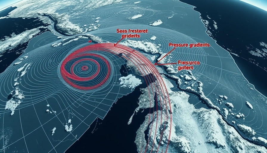
For residents of the high desert, keeping an eye on the weather patterns along the West Coast can provide valuable insights into local conditions. Recently, meteorologists have observed a significant weather event known as the Alaska Cut Off Low, located in the Gulf of Alaska. This phenomenon greatly influences atmospheric conditions all the way down to the San Francisco Bay Area, impacting temperatures, wind patterns, and fog.

How the Cut Off Low Affects San Francisco's Weather

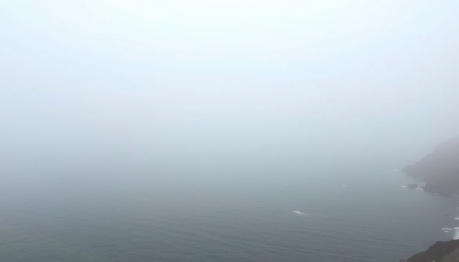
The Cut Off Low acts like a weather anchor, with its effects radiating outward. As breezes from the North Pacific High strengthen, they push surface northwest winds that usually dominate in the afternoons. This evening pattern leads to the infamous fog that San Francisco is known for, creating a juxtaposition of mild temperatures and high humidity, especially in coastal areas.

Shifting Winds: Mornings versus Afternoons

In the morning, southerly winds sweep from Half Moon Bay to Stinson Beach, but by afternoon, these winds transform into westerlies as the eddy fades away. This shift not only alters local temperatures but also affects the robustness of the winds felt in different areas, including Napa and the Stockton region. By understanding these wind dynamics, residents can better prepare for their day and plan outdoor activities.

The Fog's Role in Temperatures and Winds

Fog is more than just a scenic backdrop; it plays a crucial role in controlling temperature variances. Below the fog bank, temperatures tend to be cooler, impacting everything from agriculture to outdoor leisure plans. Understanding this correlation helps residents strategize daily activities, especially those who rely on specific weather conditions for farming or recreational endeavors.

Future Weather Predictions and Climate Awareness

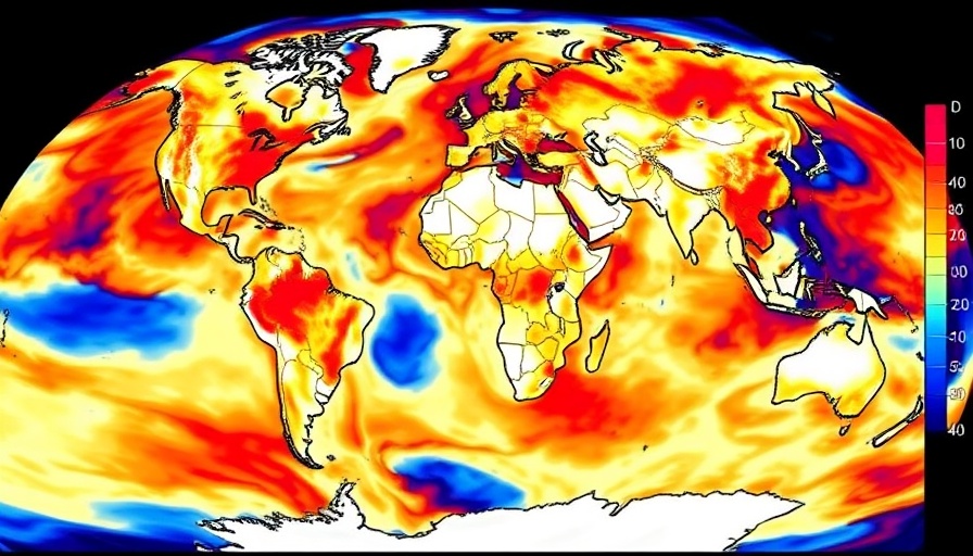
As climate change continues to challenge conventional weather patterns, events like the Alaska Cut Off Low partly reflect shifts in how atmospheric systems operate. The increased frequency of these weather anomalies prompts us to stay vigilant and educated about changing climate dynamics. Local community members can engage more profoundly with climate education initiatives or participate in discussions on sustainable practices to combat these shifts.

Creating Community Resilience Through Knowledge

The implications of the Cut Off Low stretch beyond just thermometers and anemometers—they reflect on our local lifestyle and community well-being. Embracing initiatives that promote knowledge about climate impacts fosters resilience. As individuals become informed, they pave the way for collective action toward better climate practices that can positively affect health, environment, and our cherished high desert culture.

As we engage with our surroundings, we find that understanding how weather events shape our environment can lead to proactive decisions—whether it’s for home gardening, attending local events, or simply enjoying outdoor spaces.

Climate Insights

2 Views

0 Comments

Write A Comment

*
*
Related Posts All Posts
07.27.2025

Decoding Wind Readings: Does the Anita Rock Sensor Always Tell the Truth?

Update Understanding the Anita Rock Sensor's Wind Readings The Crissy Field Anita Rock sensor is a crucial tool for wind enthusiasts and forecasters alike, providing real-time data essential for planning activities in and around the San Francisco Bay. However, many wonder: does it sometimes 'lie'? The simple answer is no, but environmental nuances can make its readings misleading under certain conditions. When Does the Sensor Miss the Mark? Strong winds from the north-west (NW) are where the sensor truly shines, accurately reflecting conditions as far as Stockton and Bakersfield. Yet, when WSW winds caused by marine surges or a strong Sacramento pressure gradient are at play, the readings can diverge sharply from the reality felt by water-goers at Crissy Field. This discrepancy stems from local geographical features that create wind shadows. For instance, dense fog or a frolicking flood may lead to calmer waters past the indicator, while the sensor, positioned above these wind shadows, continues measuring a surging breeze higher up. Anecdote from the Field: Windsurfers’ Perspective Personal anecdotes about windsurfing around Anita Rock add depth to understanding how misleading the readings can be. Mike Godsey, a local veteran of the waves, shared tales of heavy winds experienced on days when the sensor registered calm conditions. These stories matter because they illustrate not just the technicalities of the sensor's operation but also the personal stakes involved—passion and adventure turn into frustration when the weather doesn’t cooperate, and it’s critical for enthusiasts to recognize these patterns. How Geography Influences Wind Data The winds near Crissy Field can change dramatically due to the towering Presidio hills. Gordey's model effectively captures these instances, offering vital insights that can improve forecasting accuracy. Hobbyists and professionals alike benefit from understanding that perceived calm might cloak robust winds waiting just a few meters above the surface. This knowledge is invaluable for anyone gearing up for a day on the water. Moving Beyond Anita Rock: Future Sensor Deployments With the aim of maximizing accurate readings, a new sensor was set up on the concrete cofferdam around the America’s Cup tower, but logistics complicated its permanent installation. The previous attempts to overcome Anita Rock's challenges highlight the community’s dedication to providing reliable data for all outdoor enthusiasts. As the region looks to the future, innovations and technology could better capture wind patterns for everyone’s benefit. Final Thoughts: Join the Wind Community Understanding how local factors affect readings from the Anita Rock sensor can enhance your experience in the great outdoors. As environmental challenges continue—adapting to climate change and local fluctuations becomes even more vital. Remember, knowing how to interpret these readings can make all the difference whether you’re a seasoned windsurfer or a casual beachgoer. For anyone in the high desert interested in climate issues and local adventures, connect with your community and share experiences to build a collective understanding of our ever-changing environment. Let's continue to explore the winds, deepen our knowledge, and enjoy the exhilarating experiences they bring!

07.24.2025

Understanding the Influence of Cut-Off Low on Winds in Our Bay Area

Update Understanding the Impact of the Cut-Off Low on Local Weather In the ever-changing climate of California, weather patterns can significantly shape our daily experiences. Recently, a Cut-Off Low system approximately 18,000 feet above sea level has been influencing local wind dynamics, creating a complex interplay of effects that are particularly important for our desert community. This weather pattern has effectively blocked the typical northwestern ocean winds, redirecting flows to enhance WSW winds instead. For residents in the high desert, this means we can expect a shift in temperature and wind conditions. As these WSW winds strengthen, they begin to turbocharge the surface winds across various locations, including Sherman Island and the North Tower, generating gusts that can surpass typical forecasts. The Effect of Coastal Eddies and Marine Layers The presence of strong WSW winds also plays a role in the formation of coastal eddies and a broken marine layer. This results in interesting weather phenomena that can lead to cool breezes in areas like Bay Point and Berkeley. Residents visiting these robust coastal regions during foggy days might experience surprising changes in temperature and visibility, making it an intriguing time for nature lovers and outdoor enthusiasts. Moreover, as the WSW winds funnel through the gaps in the Coast Range towards the more populated Sacramento and Stockton areas, they provide a fresh reminder of how interconnected our local climates are. The interaction between these wind patterns enhances not just our weather but our landscape, too. Pivotal Observations for Local Wind Enthusiasts For those engaged in outdoor activities, especially windsurfing and sailing, it’s vital to pay attention to these wind changes. The forecasted winds at Coyote and 3rd launch sites might not appear strong, but conditions are expected to be deceptive — with occasional gusts of 20 mph reported in channels close to shore. The unpredictability of these winds, especially in the Sherman Island area, promises a challenge and thrill for those ready to embrace it. Fog Conditions and Fun Opportunities If fog permits in the northern regions, expect wind speeds navigating between upper-teens and low twenties, creating a perfect setting for a day on the water. Knowing when and where to take advantage of these weather changes can truly enhance your local experience. Enthusiasts should also keep an eye on places like Waddell and Natural Bridges, which may present unexpected opportunities for fun as they respond to the changing winds. Engaging with the Weather For residents in the high desert, understanding these patterns provides not only practical insights into outdoor activities but also allows for a deeper connection to our local environment. Weather fluctuations impact agricultural crops, wildlife behavior, and our community’s recreational lifestyle. In these times of environmental concern, staying informed about our unique weather phenomena enhances appreciation for the beauty and challenges posed by our climate. Let this Cut-Off Low inspire curiosity and engagement with the wonders of our world, as well as the importance of community adaptation and resilience. As you navigate these weather changes, remember to embrace the spontaneity of desert life. Now is the perfect time to explore, to question, and to connect, whether it’s through family outings, solo adventures, or community gatherings.

07.22.2025

Exploring the Unusual Climate: How Coastal Coolness Contrasts With Inland Heat

Update Understanding the Climate Conundrum: Cool Coastal Summer vs. Anomalous Inland Heat Amidst the typical seasonal patterns of California, an unexpected climatic scenario has surfaced this summer as coastal areas experience an unusually cool season contrasted by scorching temperatures inland. This phenomenon raises significant questions regarding the impact of regional climate variations and broader climate change trends. What’s Behind the Cool Coastal Summer? From May through mid-July, Northern and Central California’s coastal regions—including cities like San Francisco and Monterey—have reported some of the coolest conditions in decades, with persistent marine layers, overcast skies, and strong winds setting the tone for a season that, for many locals, is characterized by an enduring chill. These weather trends, which have seen June temperatures hit lows reminiscent of the early 20th century, demonstrate the complexities of climate change, particularly in a state known for its temperate summers. Heat Waves Bucking the Trend: Inland Temperature Surges In stark contrast, areas well inland, including parts of the Sacramento Valley and the Sierra Nevada foothills, have recorded blistering heat, with temperatures reaching nearly record highs. Such dramatic variations underscore the atmospheric “thirstiness”—a phenomenon driven by diminished moisture levels resulting from higher evaporation rates. This contradiction between climates across short distances brings to light crucial considerations about regional microclimates and their implications for agriculture, wildlife, and local ecosystems alike. The Role of Climate Change in Daily Weather Patterns Research indicates that while annual temperatures across California have steadily increased, the impact of climate change appears to be less pronounced along the coast regarding early summer months. Many areas along the northern and central coastline have shown minimal warming in comparison to their inland counterparts, where substantial temperature increases have occurred over the past four decades. This finding illustrates the concept of 'shifting baseline syndrome,' as older generations perceive climatic shifts through a narrow lens of their recent experiences. A Deeper Dive: Historical Context and Future Predictions Understanding the historical context of weather patterns is essential to grasp the implications of present-day anomalies. Californians have experienced fluctuating weather conditions across decades, often punctuated by extremes. As climate models adjust, urban planners, policymakers, and residents must prepare for these changes. Predictive models suggest that the increased frequency of such contrasting weather conditions may lead to pressing challenges in managing local resources, such as water and energy supply, and addressing the impacts on vulnerable communities. Final Thoughts: Understanding How Climate Affects Our Lives As we navigate the complexities of climate change, it is crucial for Californians to remain informed and engaged with their local environments. Recognizing the varying implications of weather patterns—particularly how they contrast across different regions—can help residents, businesses, and policymakers make more informed decisions that align with changing natural conditions. Taking action to mitigate climate impacts starts with awareness, advocacy, and adaptability.

Terms of Service

Privacy Policy

Core Modal Title

Sorry, no results found

You Might Find These Articles Interesting

T
Please Check Your Email
We Will Be Following Up Shortly
*
*
*