Add Row
Add Element
update
High Desert Thrive News
update
Add Element
  • Home
  • Categories
    • Local News
    • High Desert Lifestyle
    • Home Services
    • Restaurants
    • Adventure Trails
    • Wildlife Wonders
    • Climate Insights
    • Health
  • Featured
July 03.2025
3 Minutes Read

Harnessing Understanding of Marine Layer Clouds and Wind Fades

Marine layer clouds and wind fade analysis with weather graphs.

Understanding Marine Layer Dynamics

As we navigate the warm, windswept days of summer, it’s crucial to understand the intriguing phenomena occurring in our atmosphere, particularly along the West Coast. The marine layer, a thick blanket of low clouds typically found in coastal areas, plays a significant role in shaping wind dynamics. Daily forecasts often highlight the potential for sudden changes in wind patterns, especially when these clouds interact with geographical features like hills and valleys.

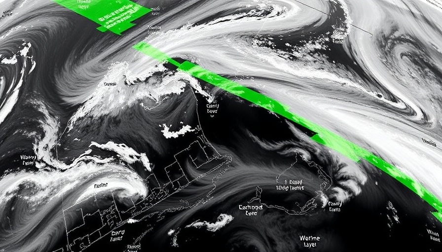
What Are Abrupt Fades and Why Do They Matter?

According to a recent forecast, many areas—especially the picturesque Peninsula—should brace for "abrupt fades." But what exactly does this mean? Abrupt fades are sudden drops in wind strength that can catch even seasoned sailors by surprise. When the wind is strong aloft, it can create what we refer to as ripples as it interacts with the topography of the land. These ripples can lead to periods of calm—also known as "lulls"—where the winds may seem to vanish entirely, disrupting the expected weather patterns.

Unearthing the Beauty of Standing Waves

One of the most fascinating aspects of these meteorological events is the creation of standing waves. When the high-altitude winds hit the taller hills of California, interesting things happen in the marine layer clouds. The ripples generated can form slow-moving standing waves in the atmosphere, creating an undulating visual effect in the morning sky. It’s not just a scientific curiosity; these waves hold beauty and intrigue that many outdoors enthusiasts can appreciate.

The Interplay of Winds and Local Geography

The interaction between the geographical landscape and aerial phenomena underlines the unique characteristics of the West Coast's climate. For the residents of high desert communities, understanding these winds not only enhances their appreciation for the local environment but also helps them prepare for weather conditions that can drastically shift within minutes. Wind patterns impact daily activities, leisure, and even health—especially for those engaging in outdoor sports.

Future Predictions: Embracing Change in Climate

As discussions around climate change continue to take center stage, the relationship between marine layer clouds and regional winds is an essential piece of the puzzle. With fluctuations in temperature and significant changes in atmospheric pressure occurring due to global warming, we may see an increase in the frequency and intensity of wind events. It’s an important reminder for residents of the high desert to remain informed about these environmental changes, as they could inform our local climate responses and initiatives.

Local Perspectives: Personal Stories on Wind and Weather

Moreover, exploring the winds of change isn't limited to just weather forecasts; it's deeply personal. Local artisans in the high desert often find inspiration in the shifting winds and clouds, using elements of nature in their crafts, while farmers consider these weather patterns crucial for their crops. Let’s cherish these stories that highlight how interconnected we are with our environment.

Understanding the winds of the West Coast does more than just prepare us for daily activities; it connects us to our unique locale. Whether you're a surfer riding the waves off the coastline or a community member enjoying the colorful sunsets ignited by a fading marine layer, recognizing these phenomena can deepen your relationship with the land.

Climate Insights

11 Views

0 Comments

Write A Comment

*
*
Related Posts All Posts
10.09.2025

Hurricane Priscilla's Remnants to Bring Significant Rain to Southwest

Update What’s Impacting the Weather in the Southwest?As the remnants of Hurricane Priscilla swirl off the Pacific, regions in the Southwest, particularly Southern California, are bracing for a wave of rainfall and thunderstorms. Starting Thursday through the weekend, moisture will sweep into Southern California, potentially bringing heavy rainfall to the area.This weather shift comes after a notably warm September, with California experiencing milder than usual temperatures. High humidity, coupled with unpredictable rainfall, has provided a silver lining in fire hazard mitigation across the state. Atmospheric conditions have helped keep fire risks low, but precaution is vital as storms approach.Late-Season Rain: A Double-Edged SwordThe arrival of precipitation in Southern California is part of a larger weather pattern that has exhibited unusual characteristics this season. Farmers and local residents may find the rains welcome; however, as seen in previous events tied to moisture from tropical storms, these systems can easily tip into dangerous territories. Flash flooding remains a possibility as these storms move through the region, which could cause complications in flash watershed areas.In regions like Phoenix, Arizona, assessments indicate potential rainfall up to 1.25 inches, easing into the area by Friday. The expected steady trickle of rain, rather than sudden downpours, should mitigate flash flooding risks associated with sudden deluges. Despite careful measurements, even gradual storms can lead to localized flooding, particularly in areas unaccustomed to substantial moisture.Climate Context: Why This Matters NowThe unusual September warmth across California and parts of Nevada has highlighted ongoing shifts in climate patterns driven by warming ocean temperatures. Studies indicate that the current marine heatwave is influencing atmospheric conditions, creating environments conducive to rain events that many attributed to seasonal shifts. This especially impacts local agriculture and public safety.As we witness these systems moving along the coast, it’s essential to keep an eye on the broader implications of prolonged rainfall patterns. While much of Southern California is not expected to face the shocking intensity of previous storms, cumulative rain here could lead to resource management and urban drainage challenges, raising questions on preparedness for potential future extremes.Looking Ahead: What’s Next in Weather Patterns?Forecasts suggest that the wet weather isn’t going to dwindle just yet. Meteorologists anticipate that additional tropical systems may develop, fuelling ongoing rainfall opportunities in the next week. Communities should prepare for an active weather period as moisture flows in from the remnants of Priscilla, indicating potential further storms approaching from the south.As we consider the current landscape of the Southwest’s weather, proactive engagement with local forecasts and readiness for unpredictable weather can enhance safety and comfort for residents. The convergence of tropical moisture patterns calls for monitoring and community awareness as serious consequences can arise from even staggered rainfall.Taking Action: Stay Informed and PreparedFor residents in the Southwest, remaining vigilant about weather conditions is crucial. Sign up for local alerts and keep track of updates from meteorological services as new information emerges about approaching weather systems. While we have seen beneficial rain, it is essential to respect the power of these weather patterns and ensure safety measures are in place. Increased rainfall may ease fire threats, but it also brings new risks that require community preparedness.

09.28.2025

Exploring Big Eddies: Understanding Wind Patterns That Shape California's Coast

Update Understanding Big Eddies: The Phenomenon Behind the Wind Have you ever wondered what causes those strong winds that whip through the California coast? On a recent Saturday, we saw a perfect example of how weather patterns, particularly the influence of Big Eddies, shape our local climate. This fascinating atmospheric phenomenon is not just a meteorological curiosity; it plays a crucial role in how winds, especially from the Gulf of Alaska, manifest along our coastline, affecting everything from kite flying to boat navigation. The Anatomy of an Eddy The genesis of our featured eddy began with a storm system emerging from the Gulf of Alaska, which eventually pushed high-pressure systems into the Pacific Northwest. This chain reaction caused a low-pressure area to bulge over a wide swathe of the coast—from Sacramento through Bodega Bay down to Southern California. This unique setup creates a pressure gradient that stirs up the winds, allowing Big Eddy to stretch its influence from San Diego all the way to Mendocino. Wind Patterns Explained As the south coast winds approach critical gaps, like the Hwy. 92 and Golden Gate, they undergo fascinating changes—they curve and gain speed, propelling towards the Sacramento pressure gradient. This results in varied wind speeds across different locations; for instance, at the North Tower, wind speeds soar in the low 20s, while less exposed places like Point Blunt see a decrease to the upper teens. Interestingly, this creates a complex tapestry of wind strength and direction, which can hugely affect local outdoor activities. Why Big Eddies Matter for Local Communities For adults in the high desert area, understanding these weather patterns can make a significant difference. Not only does it enrich our awareness of climate dynamics, but it also has practical implications for daily life—from planning outdoor events to managing agriculture. As climate issues increasingly threaten local environments, recognizing how weather phenomena like Big Eddies influence conditions helps communities adapt and thrive. Looking Ahead: The Future of Wind Patterns As our climate continues to evolve, keeping an eye on systems like Big Eddies will be vital. Enhanced knowledge of these wind patterns can empower our community to take proactive steps in addressing potential climate challenges. By coming together, sharing information, and adapting our activities in response to these natural phenomena, we can foster a stronger relationship with our environment. A Call to Action As you embark on your next outdoor adventure or community gathering, take a moment to appreciate the hidden forces that make our unique weather possible. Share this knowledge with others, explore local climate events, or even contribute to discussions about weather patterns in your area. Together, we can create a more resilient community in the face of a changing climate.

09.22.2025

Discover the Impact of Late-Season NW Winds on California's Coast

Update Understanding Late-Season Northwest Winds in CaliforniaAs summer gives way to autumn, the dynamics of wind patterns along the West Coast become increasingly intriguing, especially for those living in the high desert eager to understand the climate's nuances. The late-season Northwest (NW) winds bring a blend of meteorological factors, which create a unique experience for residents and wind enthusiasts alike.The Impact of Cold Fronts on Coastal WindsThis week, a distant cold front is exerting its influence on local winds, compacting the NW ocean winds along the coast. This compaction is crucial for understanding how local wind patterns develop. As the cold front moves closer, it alters the pressure systems, leading to notable changes in wind behavior across significant launch sites. The winds aloft, measuring approximately 1000 feet above ground, are expected to generate gusty conditions along popular spots such as Waddell and Bodega Bay.Cumulative Effects of Pressure GradientsAs the morning fog begins to lift, the difference in pressure between the coastal region and areas further inland, like Bakersfield and Stockton, plays a pivotal role. This gradient intensifies the winds, producing strong gusts that can reach upper teens to low twenties according to recent observations. Launch sites like Crissy Beach and Coyote Point are set to experience the brunt of these gusts, presenting both challenges and exhilarating opportunities for adventurers.Gearing Up for Windy AdventuresFor residents and adventurers in the high desert, these weather fluctuations signal a perfect time to explore outdoor activities that take advantage of the winds. The anticipated strong gusts at local launch sites can lead to thrilling experiences in wind sports such as kitesurfing and windsurfing. Understanding these wind patterns can prepare enthusiasts to maximize their time on the water while remaining safe.The Human Connection to Climate PatternsBeyond the technicalities, the changing winds also reflect broader climate issues that impact our local environment. Everyone has a role to play in understanding these patterns and their effects. Engaging with local weather initiatives can strengthen community bonds and foster a collective approach to addressing the emerging climate challenges that affect us all.Join the ConversationAs the winds shift, so too can our perceptions of the climate around us. Keep track of these forecasts, and connect with other residents interested in the local climate issues. By sharing experiences and stories, we can cultivate a deeper understanding of our ever-changing world – one gust at a time.

Terms of Service

Privacy Policy

Core Modal Title

Sorry, no results found

You Might Find These Articles Interesting

T
Please Check Your Email
We Will Be Following Up Shortly
*
*
*