Add Row
Add Element
update
High Desert Thrive News
update
Add Element
  • Home
  • Categories
    • Local News
    • High Desert Lifestyle
    • Home Services
    • Restaurants
    • Adventure Trails
    • Wildlife Wonders
    • Climate Insights
    • Health
  • Featured
October 26.2025
2 Minutes Read

California Weather Outlook: Expect Warmer, Drier November Days

California November weather forecast showing temperature anomalies.

California's Weather Transition: From Wet October to Warm November

The past month has offered Californians a refreshing change of pace with a notably cool and wet October, particularly across the central regions of the state. As we move into November, however, a significant shift is expected, bringing with it warmer and drier conditions that could change the outdoor landscape and community activities.

What Changed From October to November?

Over the last 30 days, California saw considerable precipitation that was both beneficial and unusual for this time of year. According to climatetoolbox.org, the statewide average for rainfall exceeded long-term averages, blessed by several rain events due to persistent warm ocean temperatures influencing the atmosphere.

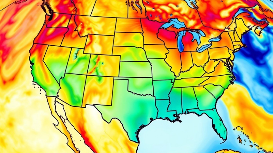
As we transition into November, strengthened weather patterns are leading to predictions of extensive ridging across the region. As these patterns take hold, California is projected to experience consecutive warm and dry days throughout the month.

Anticipating Warmer Days Ahead

Forecasts suggest unmistakable warmth in the days to come, with some areas, particularly in Southern California, likely to see temperatures rise significantly above the seasonal norm. The average maximum temperature is expected to hover around 22°C (approximately 72°F), with some days potentially more vigorous. This shift offers a stark contrast to the cooler October temperatures that dominated the state.

Moreover, daytime sunshine will be abundant, averaging about 7 hours a day, providing perfect conditions for outdoor activities such as hiking and community events.

Preparing for a Drier Season

While October provided some reprieve against potential wildfire hazards with abundant rainfall, the drier days of November could impact fire management strategies moving forward. With an average of only four rainy days and about 51 mm of precipitation expected throughout the month, residents might need to be vigilant as the drier conditions could rekindle fire risks in more arid regions.

This weather outlook underscores the importance of preparation and awareness as Californians navigate their plans for the upcoming month. Reportedly, this shift in weather should lead to a quieter fire season than initially anticipated.

Recommendations for the Community

As Californians gear up for the warmer and drier days ahead, it might be wise to consider outdoor outlines during the balmy afternoons. Parks and recreational areas could become increasingly popular, as the pleasant weather invites residents to explore and engage with their surroundings.

Additionally, keeping an eye on weather forecasts will allow individuals to adapt their climate-sensitive activities. Strategies for maintaining fire safety during this warmer weather, including reducing potential fire hazards in yards and gardens, will be essential for communal safety.

Conclusion: Abundant Sunshine Ahead!

This November promises a transition from the cooler, wetter conditions of October to a warmer and more inviting climate across California. With increased sunshine and reduced rainfall, it presents a perfect opportunity for outdoor adventures and community gatherings, while also reminding us of our seasonal fire management practices.

Climate Insights

3 Views

0 Comments

Write A Comment

*
*
Related Posts All Posts
11.04.2025

California's Dramatic Weather Shift: Atmospheric River Storm Ahead

Update California’s October Surprise: Notable Warmth Precedes Upcoming Storm This fall has proven unusual for California, especially in Northern regions where the closing days of October brought a remarkable stretch of warmth. With temperatures surpassing typical late October highs and setting records in several locations, residents across the state have found themselves basking in unseasonably warm weather. In just a week, however, forecasts have shifted dramatically, signaling a quick turn towards wetter conditions as an atmospheric river approaches the North Coast. Unveiling the Atmospheric River Impact The atmospheric river set to hit Northern California brings with it heavy rainfall and gusty winds, predicted to commence on Tuesday and wrapping up through Wednesday. This system combines extremely moist air with dynamic lift, promising substantial precipitation that could exceed several inches in areas like the North Coast and southern Oregon. Notably, this system’s southern extent appears to have changed, now affecting regions farther south than initially anticipated—potentially stretching to areas as far as San Francisco and Monterey Bay. Differing Impacts: Wet North vs. Dry South A critical aspect of this weather pattern is the 'dipole effect,' where Northern California is targeted for heavy rain while Southern California remains dry. As the storm builds, Northern regions could see flooding, particularly in urban settings where runoff is a concern. Conversely, Southern California could continue experiencing the warm, dry conditions that have marked October. This disparity poses challenges for local infrastructure and wildlife, especially since a majority of the foliage is still intact, making it vulnerable to strong winds and potential uprooting. Historical Context: A Repeat of Past Patterns Historical weather patterns indicate that such late-season atmospheric rivers are not entirely out of the ordinary. California’s climatic variability has made it susceptible to abrupt shifts, particularly as atmospheric conditions change dramatically within weeks. The duality of dry versus wet in different parts of the state serves as a reminder of just how fragmented California's climate can be, leading to varied impacts on agriculture, water supply, and wildfire risk. Preparing for the Upcoming Weather Changes As meteorologists predict incoming storm disturbances, several preparations can help mitigate adverse effects. Residents in affected areas should be mindful of potential localized flooding and ensure drainage systems are clear and operational. It’s also wise to secure outdoor items to prevent wind-related damage. The upcoming weather will serve as a crucial test, especially in regions recovering from previous seasons of drought. The stakes are high as we navigate this erratic climate reality, especially with wildfire activity still a concern due to the recent heat. Future Projections: More Rain or a Return to Normalcy? Looking ahead, forecasts suggest ongoing fluctuations with the potential for more rainfall later this month. While the current storm brings immediate concerns, its resolution might lead to a period of uncertainty—the kind that could set the stage for either further precipitation or a return to warming trends. As there is greater uncertainty projected for Southern California, stakeholders across sectors—from agriculture to public safety—should stay informed and adaptable as conditions evolve. In summary, as we prepare for this transition from warmth to a forecasted deluge, it’s essential to remain vigilant and informed regarding not only our immediate safety but the longer-term implications of continuing unpredictable climate patterns. More than ever, community awareness and preparedness will play key roles in navigating these dynamic events. Stay tuned as we continue to monitor these developments and provide updates on how the weather shapes our landscape and lifestyle.

10.09.2025

Hurricane Priscilla's Remnants to Bring Significant Rain to Southwest

Update What’s Impacting the Weather in the Southwest?As the remnants of Hurricane Priscilla swirl off the Pacific, regions in the Southwest, particularly Southern California, are bracing for a wave of rainfall and thunderstorms. Starting Thursday through the weekend, moisture will sweep into Southern California, potentially bringing heavy rainfall to the area.This weather shift comes after a notably warm September, with California experiencing milder than usual temperatures. High humidity, coupled with unpredictable rainfall, has provided a silver lining in fire hazard mitigation across the state. Atmospheric conditions have helped keep fire risks low, but precaution is vital as storms approach.Late-Season Rain: A Double-Edged SwordThe arrival of precipitation in Southern California is part of a larger weather pattern that has exhibited unusual characteristics this season. Farmers and local residents may find the rains welcome; however, as seen in previous events tied to moisture from tropical storms, these systems can easily tip into dangerous territories. Flash flooding remains a possibility as these storms move through the region, which could cause complications in flash watershed areas.In regions like Phoenix, Arizona, assessments indicate potential rainfall up to 1.25 inches, easing into the area by Friday. The expected steady trickle of rain, rather than sudden downpours, should mitigate flash flooding risks associated with sudden deluges. Despite careful measurements, even gradual storms can lead to localized flooding, particularly in areas unaccustomed to substantial moisture.Climate Context: Why This Matters NowThe unusual September warmth across California and parts of Nevada has highlighted ongoing shifts in climate patterns driven by warming ocean temperatures. Studies indicate that the current marine heatwave is influencing atmospheric conditions, creating environments conducive to rain events that many attributed to seasonal shifts. This especially impacts local agriculture and public safety.As we witness these systems moving along the coast, it’s essential to keep an eye on the broader implications of prolonged rainfall patterns. While much of Southern California is not expected to face the shocking intensity of previous storms, cumulative rain here could lead to resource management and urban drainage challenges, raising questions on preparedness for potential future extremes.Looking Ahead: What’s Next in Weather Patterns?Forecasts suggest that the wet weather isn’t going to dwindle just yet. Meteorologists anticipate that additional tropical systems may develop, fuelling ongoing rainfall opportunities in the next week. Communities should prepare for an active weather period as moisture flows in from the remnants of Priscilla, indicating potential further storms approaching from the south.As we consider the current landscape of the Southwest’s weather, proactive engagement with local forecasts and readiness for unpredictable weather can enhance safety and comfort for residents. The convergence of tropical moisture patterns calls for monitoring and community awareness as serious consequences can arise from even staggered rainfall.Taking Action: Stay Informed and PreparedFor residents in the Southwest, remaining vigilant about weather conditions is crucial. Sign up for local alerts and keep track of updates from meteorological services as new information emerges about approaching weather systems. While we have seen beneficial rain, it is essential to respect the power of these weather patterns and ensure safety measures are in place. Increased rainfall may ease fire threats, but it also brings new risks that require community preparedness.

09.28.2025

Exploring Big Eddies: Understanding Wind Patterns That Shape California's Coast

Update Understanding Big Eddies: The Phenomenon Behind the Wind Have you ever wondered what causes those strong winds that whip through the California coast? On a recent Saturday, we saw a perfect example of how weather patterns, particularly the influence of Big Eddies, shape our local climate. This fascinating atmospheric phenomenon is not just a meteorological curiosity; it plays a crucial role in how winds, especially from the Gulf of Alaska, manifest along our coastline, affecting everything from kite flying to boat navigation. The Anatomy of an Eddy The genesis of our featured eddy began with a storm system emerging from the Gulf of Alaska, which eventually pushed high-pressure systems into the Pacific Northwest. This chain reaction caused a low-pressure area to bulge over a wide swathe of the coast—from Sacramento through Bodega Bay down to Southern California. This unique setup creates a pressure gradient that stirs up the winds, allowing Big Eddy to stretch its influence from San Diego all the way to Mendocino. Wind Patterns Explained As the south coast winds approach critical gaps, like the Hwy. 92 and Golden Gate, they undergo fascinating changes—they curve and gain speed, propelling towards the Sacramento pressure gradient. This results in varied wind speeds across different locations; for instance, at the North Tower, wind speeds soar in the low 20s, while less exposed places like Point Blunt see a decrease to the upper teens. Interestingly, this creates a complex tapestry of wind strength and direction, which can hugely affect local outdoor activities. Why Big Eddies Matter for Local Communities For adults in the high desert area, understanding these weather patterns can make a significant difference. Not only does it enrich our awareness of climate dynamics, but it also has practical implications for daily life—from planning outdoor events to managing agriculture. As climate issues increasingly threaten local environments, recognizing how weather phenomena like Big Eddies influence conditions helps communities adapt and thrive. Looking Ahead: The Future of Wind Patterns As our climate continues to evolve, keeping an eye on systems like Big Eddies will be vital. Enhanced knowledge of these wind patterns can empower our community to take proactive steps in addressing potential climate challenges. By coming together, sharing information, and adapting our activities in response to these natural phenomena, we can foster a stronger relationship with our environment. A Call to Action As you embark on your next outdoor adventure or community gathering, take a moment to appreciate the hidden forces that make our unique weather possible. Share this knowledge with others, explore local climate events, or even contribute to discussions about weather patterns in your area. Together, we can create a more resilient community in the face of a changing climate.

Terms of Service

Privacy Policy

Core Modal Title

Sorry, no results found

You Might Find These Articles Interesting

T
Please Check Your Email
We Will Be Following Up Shortly
*
*
*